EMODnet Marinas: a free European marina map for yacht owners
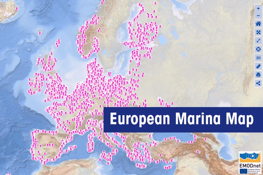
In September 2026, the European Boating Industry (EBI) announced a new layer on EMODnet, the EU’s free online map of human activity at sea: a map of European marinas. For each marina it shows the name, the exact position and, for the official records, the number of berths. Anyone can open it in a web browser. It was built for policy makers, but it is also useful when you plan a cruise and want to know where you can stop along the way.
Why Europe needed a marina map
Marinas were the missing piece on a map that already showed almost everything else at sea. EMODnet, the European Marine Observation and Data Network, is funded by the EU and brings marine data from all over Europe together in one place. Its “Human Activities” section already showed ports, offshore wind farms, fish farms, shipping lanes and protected nature areas. Marinas, however, were not there.
That was not because nobody had the data. It was because everybody had a small piece of it. Marina information sat in navigation apps, national registers and regional organisations, each with its own format, its own units and its own language. We know this pattern well. In our daily work with ship registers across Europe, we deal with many registers and many forms, and no two of them are the same.
So why does a marina map matter? Under the EU Maritime Spatial Planning Directive of 2014, every EU country with a coastline must plan how its sea space is used. Picture a planning office deciding where the next wind farm or protected zone will go. If the marinas are not on the map in front of them, they are easy to forget. A complete marina map helps to make sure that recreational boating gets a seat at that table.
Who is behind the marina map: EBI, TransEurope Marinas and Cogea
The map is the work of three partners, led by an organisation that most yacht owners have never heard of. The European Boating Industry (EBI) is the trade association of the recreational boating industry, based in Brussels. Since 2009 it has represented boatbuilders, equipment makers, marinas and service providers at EU level. Its full members are national industry associations from more than 19 European countries, and companies can join as sustaining members. According to EBI, the sector counts some 32,000 companies with more than 280,000 people in direct employment.
You may never deal with EBI yourself, but you have probably seen its work. EBI took part in the revision of the Recreational Craft Directive, the EU rules behind the CE marking on your yacht.
The second partner, TransEurope Marinas, is a network of marinas across Europe with reciprocal berthing arrangements: a long-term berth holder in one member marina gets a discount when visiting another. The third partner, Cogea BIP Group, collected the data and turned it into one harmonised dataset.
The first data came from four organisations: the Association of Estonian Marine Industries, the Fédération Française des Ports de Plaisance (the French marina federation), The Yacht Harbour Association from the United Kingdom, and TransEurope Marinas itself.
How to open the EMODnet marina map
You need no account and no software to see the marina map, only a web browser and five clicks:
- Go to the EMODnet map viewer.
- Select the tab “Catalogue”.
- Type “marinas” in the search field.
- Select “Marinas”.
- Select “EMODnet Marinas”, “OpenStreetMap Marinas (area)” and/or “OpenStreetMap Marinas (points)”.
The last step offers three layers, and our first question was the obvious one: what is the difference?
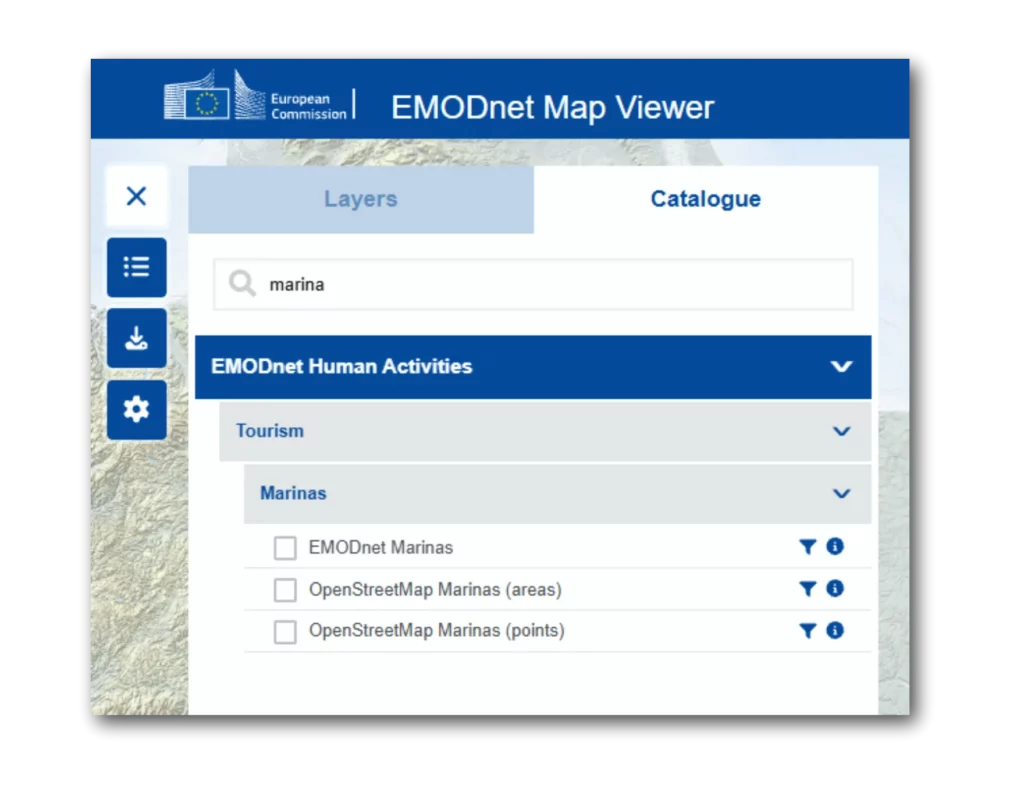
Three marina layers: EMODnet Marinas and the two OpenStreetMap layers
The three layers differ in where the data comes from and in how much they tell you. Only “EMODnet Marinas” is based on official data from national associations and marina networks. The other two come from OpenStreetMap, the free world map that volunteers build and update, a little like Wikipedia but for maps.
Why two OpenStreetMap layers? When a volunteer adds a marina to OpenStreetMap, the preferred method is to draw a line around the whole marina: pontoons, water and shore facilities. When the aerial photos are not clear enough for that, the volunteer places a single pin in the middle instead. EMODnet keeps the outlines and the pins apart: “area” holds the outlines, “points” holds the pins.
| EMODnet Marinas | OpenStreetMap Marinas (points) | OpenStreetMap Marinas (area) | |
|---|---|---|---|
| Source | Official data from national associations and marina networks | OpenStreetMap volunteers | OpenStreetMap volunteers |
| Shown on the map as | One point per marina | One point per marina | The outline of the marina |
| Number of berths | Yes | No | No |
| Other details | Name, country, position, data source | Name, country, coastal or inland, notes, position | Name, country, coastal or inland, notes, surface area in km² |
| Which marinas | Marinas with at least 50 berths | Selected marinas, no minimum size given | Selected marinas, no minimum size given |
| Countries | Belgium, Croatia, Estonia, France (also Guadeloupe, Martinique and Saint-Barthélemy), Germany, Greece, Guernsey, Ireland, Italy, Jersey, Montenegro, Netherlands, Spain, United Kingdom | All EU countries, plus Albania, Bosnia and Herzegovina, Faroe Islands, Georgia, Guernsey, Iceland, Isle of Man, Jersey, Monaco, Montenegro, Norway, Turkey, Ukraine, United Kingdom | Same as the points layer |
So the official layer tells you how large a marina is, and the OpenStreetMap layers fill the gaps in between. As more official data comes in, EMODnet will review the OpenStreetMap records and replace them where needed. Our tip: switch on all three.
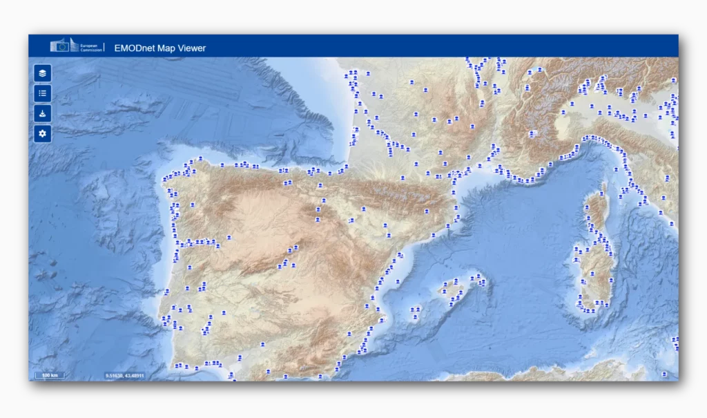
Using the marina map to plan your route
For a yacht owner, the map works best as a first overview, before you open your charts and pilot books. Say you plan to take your boat from Zeeland down the Channel to Brittany. With the EMODnet Marinas layer switched on, you see the larger marinas along that coast and how many berths each one has. A marina with 1,000 berths is more likely to have a free place for a visitor on a busy August weekend than one with 60, although we would still call ahead. The OpenStreetMap layers add smaller marinas, and their “coastal or inland” label helps when your route follows rivers and canals.
It is just as useful to know what the map does not do. It is not a navigation chart and not a booking site. It shows no depths, no VHF channels, no prices and, for now, no services such as fuel or a crane. EBI plans to add information on key marina services later. The dataset was last revised on 12 June 2026, so always check with the marina itself before you set off.
We like the idea behind it: a map made for the people who plan the sea turns out to be useful for the people who use it.
Helping to complete the marina map
The map is far from finished, and EBI asks for help to complete it. National associations, marina networks and other organisations that hold marina data can find out how to contribute on the EBI website. If your home marina is missing, a word with the harbour master might just put it on the map.
The map shows you where to stop. If you have questions about the papers your yacht needs on board when you get there, do drop us a note.
Sources
- European Boating Industry, European marina mapping on EMODnet: supporting effective decision-making, 1 September 2026
- TransEurope Marinas, TransEurope Marinas & EBI bring marina data to EMODnet
- EMODnet Human Activities, dataset description of “EMODnet Marinas” (web service record)
- EMODnet, map viewer
- OpenStreetMap Wiki, Tag: leisure=marina
- European Boating Industry, Our members
- IMCI, European Boating Industry